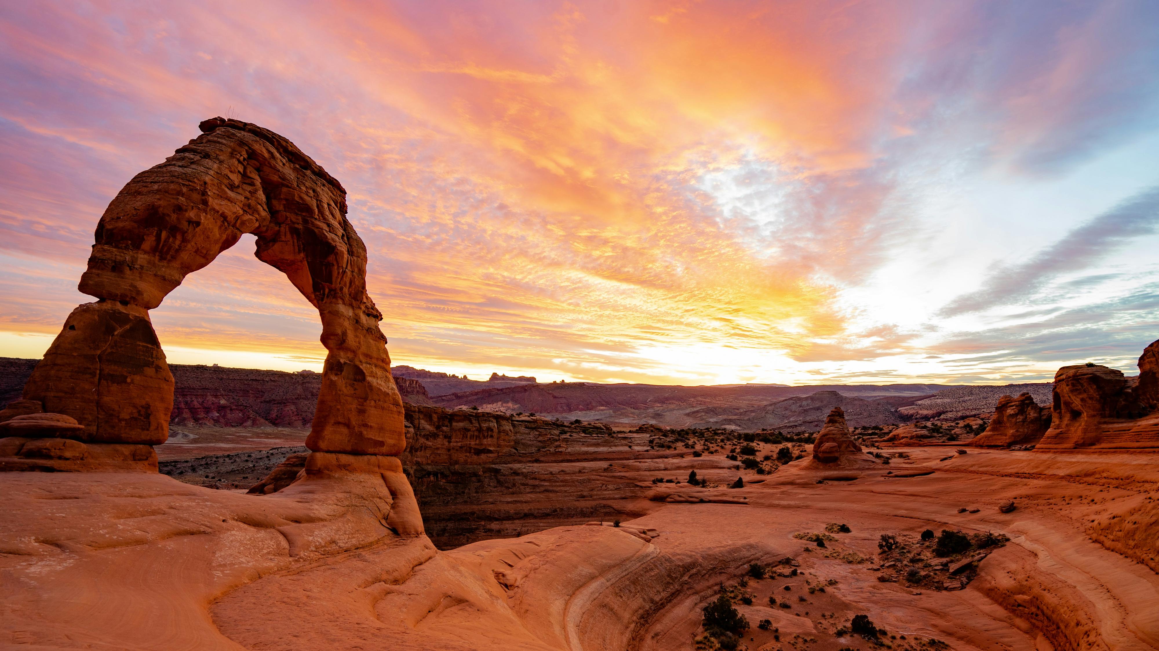
The Potash Road, Utah Hwy 279

 This 17-mile road is also known as the Potash-Lower Colorado River Scenic Byway. This road runs alongside the Colorado River and provides great views of the river, ancient rock imagery, and dinosaur tracks. This byway begins four miles north of Moab, where Potash Road turns off of US Hwy 191. After about two miles, the road enters the deep gorge of the Colorado River, which is called The Portal since the river is entering the deep canyon walls. You can often see rock climbers on the cliffs along the section locally referred to as Wall Street. The paved highway ends at the Intrepid Potash Mine where potash, a mineral often used as a fertilizer, is extracted.

Upper Colorado River Scenic Byway, Utah Hwy 128

Known as “The River Road,” this spectacular route along the Colorado River gorge begins at the Colorado River Bridge on the north end of Moab. For the first 13 miles it parallels the Colorado River within a narrow section of the gorge, providing breathtaking views of the surrounding red sandstone cliffs.

After 24 miles, the highway passes a vantage point for one of the most magnificent views in the West, the red-rock spires of the Fisher Towers set against the peaks of the La Sal Mountains. After leaving the valley, the road winds farther up the river gorge until arriving at the site of historic Dewey Bridge. It was Utah’s longest suspension bridge and, at the time of its construction in 1916, the 2nd largest suspension bridge west of the Mississippi. Unfortunately Dewey Bridge was destroyed in April 2008 by a brush fire. You can turn around or continue on to connect with I-70.

The La Sal Mountain Loop Road

This is a classic mountain drive to the elevation of 10,147ft that features spectacular scenery ranging from the lush forests of the La Sal Mountains to expansive views of the red-rock landscape below. Open seasonally.

This road begins on US Hwy 191, six miles south of Moab. At Old Airport Road turn left off US Hwy 191 to begin the 62-mile loop. These mountains outside Moab offer cool relief from the desert’s hot summers.

After a swirling descent down the switchbacks, the views overlooking Castle Valley are stellar. Turn left on Utah Hwy 128 to return to Moab.

Heading south/trail of the Ancients

US Hwy 191 is a major north–south highway through the eastern part of Utah. From Moab and Monticello to Bluff, the scenery on this drive is outstanding. 

For a side-trip, turn off US Hwy 191 onto Utah Hwy 211 for 12 miles to Newspaper Rock, a large collection of petroglyphs, some dating 2,000 years old.

On US Hwy 191 to Monticello, the horizon is dominated by the Abajo (or Blue) Mountains. From Monticello to Blanding, take the Abajo Blue Mountain Drive, a 40-mile scenic drive climbing out of the red-rock desert country to mountain scenery, through the Manti-La Sal National Forest.

Blanding is the beginning point for the Trail of the Ancients, a 100-mile loop through the heart of San Juan County. From Blanding, Utah Hwy 95 will take you into the heart of the Bears Ears National Monument and to Natural Bridges National Monument.

Take Utah Hwy 261 to access Goosenecks State Park via the unforgettable Moki Dugway, then to Utah Hwy 163 to continue to Monument Valley Navajo Tribal Park.