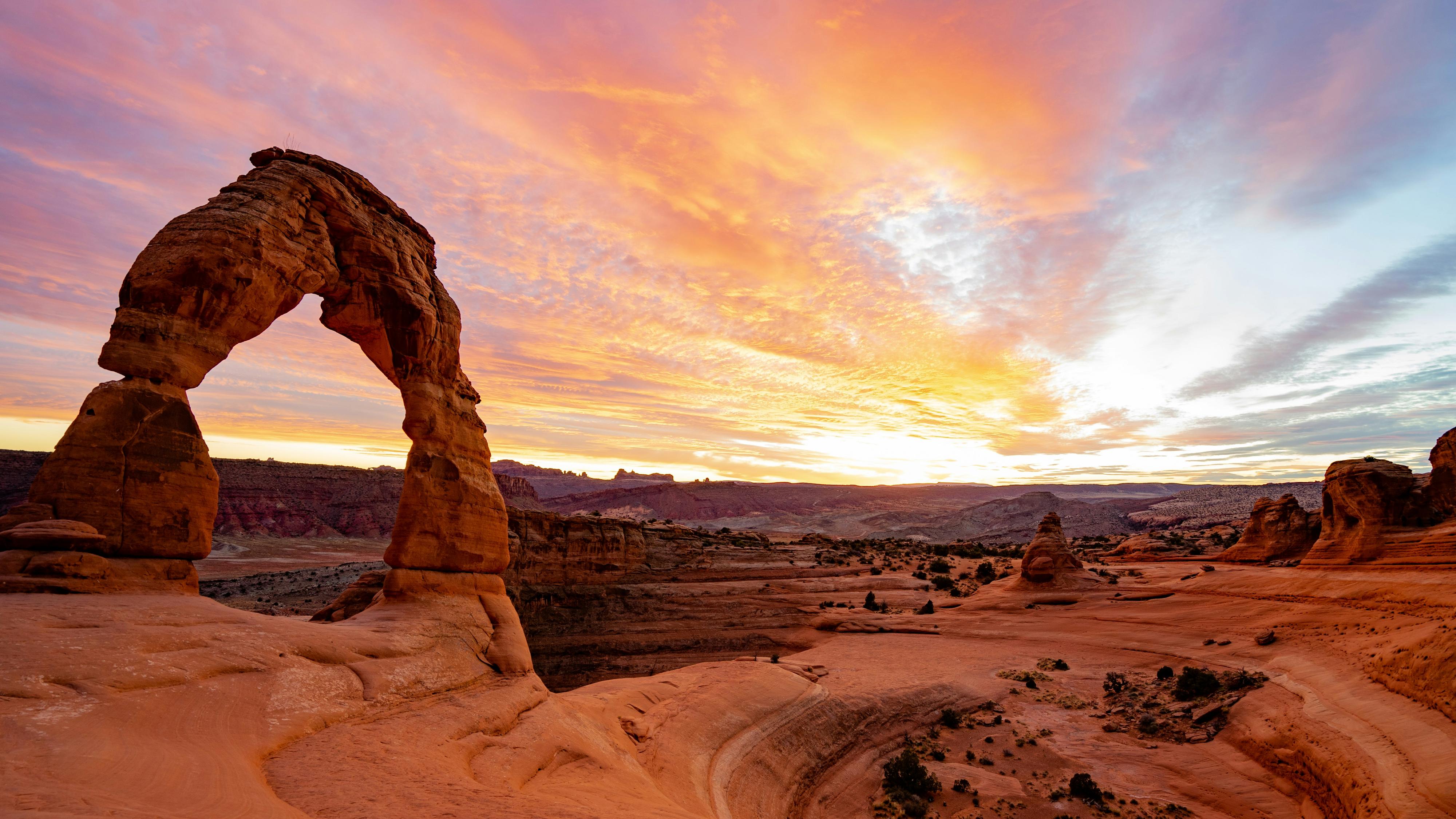
Moab has some of the best bike riding in the world, from beginner rides through scenic canyons to technical slickrock trails. This variety of terrain means there are great options for riders of all abilities.

Be safe and be prepared

There are bike lanes off the main road. Ride those to avoid the traffic on the Main Street.

Whatever mode of two-wheel transport you choose, be prepared for quickly changing weather conditions—rain deluges move in fast and with a fury. Carry a jacket, a pump and extra tube, and have sufficient water and snacks as there are no services on many of the rides.

Always ride single file and respect other users. Cyclists must obey the same traffic laws as cars. Don’t surprise anyone; use hand signals when turning.

When riding in national or state parks, you must pay the entrance fee or have a park pass and your ID.

Electric Bikes

E-bikes, as they are called, are battery-powered bikes designed to assist a rider usually in the pedal stroke. They are not designed to do all of the work, as the rider still needs to pedal.

E-bikes are considered a motorized vehicle, so therefore, use on the trails in this area is regulated. E-bikes are not allowed on any trails designated for non-motorized use; this includes all of the paved bike paths. However, they are allowed on any trail designated for motorized use such as Slickrock, Sovereign, and Hurrah Pass.

Dead Horse Point allows them on their bike trails. It’s best to check at the Moab Information Center before planning your e-bike ride.

For more information, visit discovermoab.com/ebikes.

Paved Bike Paths

Moab Canyon Pathway loosely follows US Hwy 191 North past Arches National Park and climbs toward Utah Hwy 313 (to Canyonlands National Park and Dead Horse Point State Park).

The path begins in town at 500 West (Denny’s), heads north crossing under Utah Hwy 128 and then over the river on an incredibly scenic bridge.

Stop in for a snack or lunch at Moab Giants at the intersection of US Hwy 191 and Utah Hwy 313 before heading back.

This path is great for riding to access the Moab Brands trails or to return to town after a Mag 7 shuttle.

Colorado Riverway Non-Motorized Path is a paved path that follows the Colorado River on Utah Hwy 128, almost to the parking area of Porcupine Trail. From the bridge, the trail follows the river and is 1.4 miles to Goose Island Campground. The path goes through the campground and continues another 0.6 miles.

If you are riding back to town from the Porcupine Rim trail, please ride the path rather than the road.

Lions Park, at the junction of US Hwy 191 and Utah Hwy 128, is at the intersection of the paved bike paths. It has ample vehicle parking, restrooms on both sides of the highway, and a picnic pavilion.

Note: Stick to the bike path whenever you can. It is safer and more relaxing to ride on paths with no vehicles.

Favorite Rides for the Townie Fan

Chill out by taking your two wheels to either of the paved paths listed above. Both are great, non-technical ways to relax and take in the sights while riding. The paved paths are perfect for families and riders of all abilities.

If you lack cruiser wheels, rent one at either Chile Pepper Bike Shop, 435-259-4688, chilebikes.com or Double Down Bike Shop, 435-259-9196, doubledownbikeshop.com.

trail crews and maps

The Grand County Trail Mix is a non-profit organization fueled by a few paid staff and committed volunteers. They work closely with federal, state, and local governments. Their volunteer crews create, update, and maintain the trails.

Each riding area has a map created by the Moab Trails Alliance (MTA) and Trail Mix. Buy the maps at local bike shops for around $2, with proceeds helping to maintain trails and build new additions. Large maps are also posted on kiosks at the parking area of each riding region. The excellent signage is a plus, but be safe and carry a map.

If the trails are wet from rain or snow, protect the trails by riding rocky trails.

For information on all the trails in the area, visit discovermoab.com/mountainbiking. The site is updated as new trails are added.

Trail Etiquette

If you are mountain biking on a multi-use trail, you must yield to all other trail users. Stop. Step aside. Don’t ride off the trail. Always alert other trail users. Pass on the left and signal by voice, “On your left.” The uphill rider always has the right-of-way.

When you approach a muddy section, please get off your bike and walk through it. Riding around the muddy section erodes the land. You could also damage the cryptobiotic soil that serves to prevent wind and water erosion. Breaking through it starts an irreversible erosional scar and puts more dust into the atmosphere.

When riding on a road, bicycles are legally classified as vehicles, so the same rules apply to both.

Trail symbolsMountain Biking Trail System - Moab

The trails are well-signed thanks to Grand County Trail Mix. They use symbols made popular by the downhill ski areas for the level of difficulty of the trails. Use them as a guide to help you decide the ride for you.

Trails marked with the difficulty rating should be similar to other trails with the same rating. These ratings are not universal and may differ from those you have experienced in other riding areas.

It’s a good idea to start on an easier trail to get a feel for desert riding at Moab’s 4,000ft and higher altitude.

The MOAB Brands/Bar M Mountain Biking Trail System - Moab This trail system is one of our favorites, and there is something for everyone in your group. These trails are a bunch of small loops that can be linked together, and all of the levels are conveniently located in one place. The system offers 31 miles of mountain biking on 17 trails. All the trails are interesting to ride, and the trails’ difficulty can change by the direction you ride them. This area is close to town and has cell reception (not many other trails do). Beginners should start with Rusty Spur Trail and Bar M Loop. More advanced riders will want to ride North 40, Bar B, or Deadman’s Ridge. Our favorite is Circle O. These are great trails to work on your slickrock riding skills. Access the MOAB Brands by driving eight miles north on US Hwy 191 to the Bar M Trails exit on the right (east) side of the road. You may also access the Brands by biking the paved Moab Canyon Pathways. There are several openings to access the Brands trails off the bike path. View a bike trail map here.

Klonzo Area Mountain Biking Trail System - Moab Klonzo has 20 miles of flowing intermediate-level trails with twists and turns. The trails are located on the east side of US Hwy 191 on Willow Springs Road (4WD only!) approximately a half mile beyond the Sovereign Trail parking lot. The trails feature different levels, are well marked, and the scenery is amazing. The south half of Klonzo includes many family-friendly trails, as well as some dinosaur tracks. View a bike trail map here.

Klondike Area Mountain Biking Trail System - Moab This area has more than 53 miles of trails. Beginners and lower-level intermediate riders will enjoy the moonscapes of Agate, Jasper, and Jurassic Trails. Intermediate and more advanced riders should try Baby Steps, EKG, Mega Steps, Nome, Homer, Alaska, Little Salty, and Klondike trails. Everyone loves the Dino-Flow Trail. Drive 17.5 miles north on US Hwy 191 to the Klondike Bluffs Road turn east at mile post 142. Drive three miles on the Klondike Bluffs dirt road to the trailhead. The Dinosaur Stomping Grounds tracksite trail starts at the MegaSteps trailhead parking area. View a bike trail map here.

Navajo Rocks Mountain Biking Trail System - Moab These trails are a combo of rock and sand, fun descents, and decent climbs perfect for the intermediate rider. The trails are on both sides of the highway and provide 18 combined miles of fun. Located on Utah Hwy 313, two parking areas on the right are 5.25 miles and 7.33 miles from the intersection with US Hwy 191. View a bike trail map here.

The Horsethief Trails Mountain Biking Trail System - Moab There are close to 15 miles of trails in this system near the Horsethief Campground. They are great fun for the solid intermediate rider. The bonus is that they interconnect with the Mag 7 and Navajo Rocks trails, so your ride can go from casual intermediate to expert, and exertion level from low to extreme. If your group has two cars, point-to-point rides are really fun. These trails are located approximately 12 miles from the junction of US Hwy 191 and Utah Hwy 313 on the east and west side. There are several parking lots off of US Hwy 191 near the campground and the Gemini Bridges Road. View a bike trail map here.

The Magnificent 7 Mountain Biking Trail System - Moab Mag 7 in the Gemini Bridges area boasts 44 miles of trails that are dedicated solely to mountain biking. There are many ways to ride loops in this area so that you can ride from your car. Park at the Arth’s Corner parking area and ride Great Escape to Little Canyon and then Arth’s. Then ride Getaway to Bull Run back to your car. A shorter loop is simply Getaway to Bull Run. Or, park in one of the two lots on the Gemini Bridges road (near Utah Hwy 313) and ride down Bull Run and back up Getaway. If you want to ride all of the Mag 7, then take a shuttle to the top and from Utah Hwy 313 ride Getaway to Bull Run to Great Escape to Little Canyon. Then exit onto the Gemini Bridges Road back to the parking lot near US Hwy 191. If you are not an expert rider, make sure to take the spur trail to the road before Goldbar. The alternate route for expert riders is from Little Canyon; climb up Gold Bar Rim across the top to a gnarly descent down the Portal. Be careful on Portal as there are drop-offs that you don’t want to ride off! View a bike trail map here. Stop by Chile Pepper or Double Down bike shops for details.

Intrepid Trail System Mountain Biking Trail System - Moab The trails at Dead Horse Point State Park (fee required) will not disappoint you for a fun day of mountain bike riding. The 16.6 miles of non-motorized trails are well marked, signed, and open to e-bikes. The trails are great for most levels of riders with views that never stop. There are no big climbs and the personality of a trail changes by the direction you ride it. The visitor center has bathrooms and water (open 9am-5pm). The gift shop sells cold and hot beverages, ice, and snack foods. View a bike trail map here.

Slickrock Bike Trail Mountain Biking Trail System - Moab This is Moab’s most famous ride; however, it is an expert-level route. The loop is 10.5 miles with constantly changing elevation mostly on Navajo Sandstone domes and fins. Plan on three or four hours to complete the trail. Several portions of the trail are marked with yellow dashes where the trail follows narrow ledges or abrupt drop-offs. Test your skills on the slightly easier but incredibly scenic 2.3-mile practice loop. View a bike trail map here. This trail is within the Sand Flats Recreation area, so there is a fee to ride this trail.

The Amasa Back Area Mountain Biking Trail System - Moab This is a challenging and great area for experienced mountain bikers. The expert-level Captain Ahab Trail goes behind Whale Rock and has become an extremely popular route. A climbing route to the top of Ahab called Hymasa, which is a bit easier than Amasa, traverses the benches that are above Amasa Back Road. These trails complement the existing Jackson, Rockstacker, and Pothole Arch. New this year is the Amasa Back Connector Trail. This 0.7 mile creekside trail allows riders to access the rest of the trail network from the parking lot without having to ride on the road. Look for this new trail that begins at the parking lot kiosk. View a bike trail map here.

The Whole Enchilada & Porcupine Rim Trail Mountain Biking Trail System - Moab This is one of the most epic rides in the world, and people come from all over to ride it. The entire ride encompasses six trails and covers 25 miles with a combination of steep single track through trees, sandstone, and dirt. Expert riders take four to eight hours or more to complete it. This journey starts at 10,500ft and climbs to Burro Pass at 11,216ft. By the time you are at the river road, Utah Hwy 128, you have descended 8,000ft and ridden from the high alpine zone back to the red-rock desert. If you don’t want to ride this entire ride, there are many starting points, for this route depending on early season snow conditions up high in the mountains, or if your legs aren’t up for the entire route. The highest starting points don’t open until July 1 at the earliest, due to snow. However, lower points open earlier. Stop by Chile Pepper or Double Down bike shops for a map and suggestions or for a shuttle. Before you get ready to bite off this epic journey, you need to be prepared. Epic means challenging, with little to no help possibly for hours. Make sure you have a good kit to fix what could break on your bike, plenty of water and food, a jacket, plenty of energy, and a well-charged phone to capture that perfect shot for your Instagram post. View a bike trail map here.

Jimmy Keen Mountain Biking Trail System - Moab Just off the Whole Enchilada trail, Jimmy Keen is a really fun trail to ride. The trail dips and turns through scrub oak and open meadows. The trail can be ridden as a loop (10.9 miles) or as an alternate to the road part of the Whole Enchilada (7.4 miles). The trail starts just west of the parking lot at the summit of the La Sal Mountain Loop Road near the Mason Draw Campground. This trail is a good place to start the Whole Enchilada in the spring. View a bike trail map here.

Events

Looking for a weekend of bike and movie festivities? The Fourteenth Annual Moab Ho-Down, Oct. 20-Nov. 1, includes bike riding, bike racing, dirt jumping, partying, and bike-movie watching. Fun for the entire family. 888-677-4688, moabhodown.com.