View park map here.

Enjoy the view

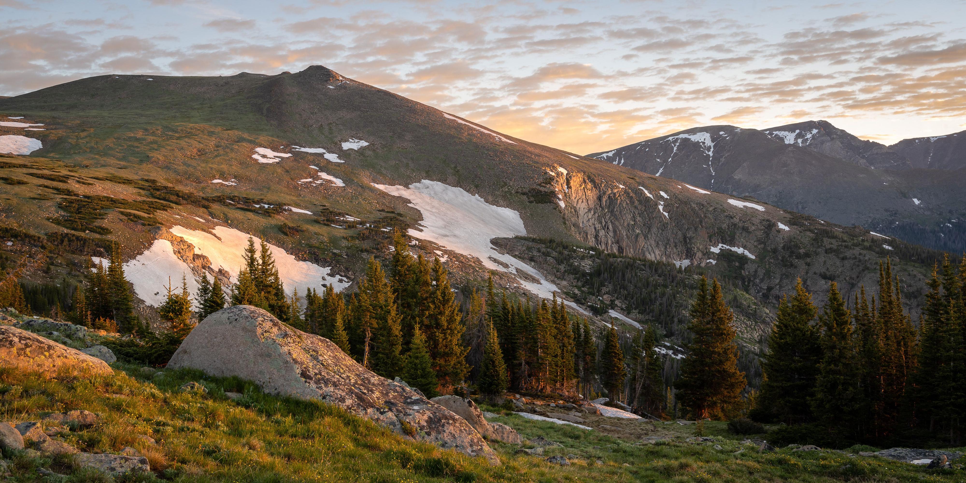
Being able to drive in the comfort of our vehicles through this amazing tundra landscape is an experience distinctly unique to Rocky Mountain National Park. Approximately one third of this national park protects lands above the treeline.

Though well maintained, Trail Ridge Road has many curves and switchbacks and is often narrow, with few guardrails or shoulders. Speed limits rarely exceed 30mph. Be patient and never pass another car as there could be an animal on the road.

Beginning in April, it typically takes snowplows up to six weeks to carve through 30ft-high drifts to clear the road, often leaving towering walls of snow next to the pavement. The road is usually open late-May through mid-October, depending on the weather. Elk, bighorn sheep, and the occasional marmot often cross the road.

Stay alert.

Opening Trail Ridge Road in the Spring

Beginning in April, it takes snowplows up to six weeks to carve through 30ft-high drifts to clear the road, often leaving towering walls of snow next to the pavement. The road is usually open late-May through mid-October, depending on the weather. Elk, bighorn sheep, and the occasional marmot often cross the road. Stay alert.

With the goal of opening the road by Memorial Day each year, clearing winter and spring snows is a monumental effort that begins in April. Crews begin to plow from both the west and east side, eventually meeting at the Alpine Visitor Center. It takes snowplows up to six weeks to carve through 30ft-high drifts to clear.

In the spring when the road is still being plowed, it is the perfect time for bikers and hikers to go without having to deal with the hassle of vehicle traffic. However, it is important to keep in mind that conditions may still be a bit tricky and that users should be prepared for high wind gusts and rapid weather changes.

For the most up-to-date information about road conditions and closures, you can call 970-586-1222.

High Season

Most people visit RMNP in summer and on fall weekends, so expect congestion on roads, in parking areas, and on popular trails. Never park along the road or on the tundra as there is no shoulder. The tundra is very fragile and will damage easily. Park only in designated spots. The busiest times in Rocky are between 10am and 3pm. By mid-morning, parking areas are often full, so tour and hike early or late in the day, nps.gov/romo/planyourvisit/trail_ridge_road.htm

Cool Tip

On the alpine tundra at the top of Trail Ridge Road it is windy and 20-30 degrees colder than Estes Park. Bring a warm jacket, hat, and gloves.

The Alpine Visitor Center

AVC sits at 11,796ft above sea level and is the highest visitor center in the entire national park system. Its large picture windows offer spectacular views. Trail Ridge Store next door has souvenirs, food, and restrooms. Test your legs and lungs on the Alpine Ridge Trail (Huffers Hill), a short, steep trek that starts at the Alpine Visitor Center and climbs 200ft in three-tenths of a mile. The trail tops out at more than 12,000ft and offers spectacular 360-degree views.

The Alpine Visitor Center is a popular spot, so go early or late in the day as the parking lot can fill up.

Trip Planner

Trail Ridge Road covers 48 miles between Estes Park and Grand Lake, so allow at least three hours for the trip. Traffic can move slowly and wildlife can be on the road. Drive with care.

Rangers and park volunteers often stop traffic in Horseshoe Park to allow Rocky Mountain bighorn sheep to cross the road and drink from Sheep Lakes, where they find vital minerals in the mud. Parking is prohibited along the road, but there is a large parking lot to view the wildlife.

Historic stone-wall turnouts provide ample space to stop and take in the views. Many Parks Curve offers expansive vistas of Horseshoe Park, Moraine Park, Deer Mountain, Mt. Meeker, and Longs Peak, the sole 14er in Rocky. Other must stops for incredible views are turnouts at Rainbow Curve, Forest Canyon, and Rock Cut.

Stop at Rock Cut to stretch your legs. Take a half-mile walk on Tundra Communities Trail for a close-up view of the many tiny alpine plants and flowers that hug the ground. Despite a growing season that may last just 40 days, flowers bathe the lush green tundra with red, yellow, blue, white, and pink blooms. Take a side trail to the fascinating Mushroom Rocks. The trail climbs to 12,319ft and ends at Toll Memorial, dedicated to Roger Toll, RMNP’s superintendent from 1921 to 1929. Stay on the trail; heavy footprints damage the fragile tundra that may take 10 years to recover.

Test your legs and lungs on the recently refurbished Alpine Ridge Trail (Huffers Hill), a short, steep trek that starts at the Alpine Visitor Center and climbs 200ft in three-tenths of a mile. The trail tops out at more than 12,000ft and offers spectacular 360-degree views.

From the Alpine Visitor Center travel west to Milner Pass and the Continental Divide. Water on the east side drains into the Platte River, which flows to the Missouri and Mississippi Rivers, and to the Gulf of Mexico. The water on the west side flows down the Colorado River to California.

At Farview Curve, that timid stream winding across the Kawuneeche Valley is the Colorado River. Yes, THE Colorado River. From here it starts a 1,450-mile journey through mountain canyons and three major deserts on its way to California. Moose and elk often graze along the river. Stop in Grand Lake for lunch before your trip back. Drive carefully as animals are often right next to the road.

Most people visit RMNP in summer and on fall weekends, so expect congestion on roads, in parking areas, and on popular trails. The busiest times in Rocky are between 10am and 3pm. By mid-morning, parking areas are often full, so tour and hike early or late in the day. nps.gov/romo/planyourvisit/trail_ridge_road.htm

Old Fall River Road

Completed in 1920 with convict labor, Old Fall River Road is a steep, gravel road that travels one way from the Endovalley Picnic Area to the Alpine Visitor Center.

Before reaching the beginning of Old Fall River Road, you’ll pass the Alluvial Fan, a massive scar left after the 1982 Lawn Lake flood. The landscape was altered again by the 2013 flood.

The scenic, nine-mile road travels beside Fall River and the shoulder of Mt. Chapin. Narrow, with several switchbacks and no guardrails, this challenging road forces the motorist to slow down and explore. (No trailers or vehicles over 25ft.) There are pull-offs to enjoy the expansive views and a small parking lot at Chasm Falls.

The road usually opens around the 4th of July. Rebuilt after the 2013 flood, the road is in beautiful shape.

Snow usually closes the road in late September or early October.

Did You Know?

Facts about Trail Ridge Road

  1. Opened in 1932
  2. North America’s highest, continuous-paved road
  3. 11 miles are at an elevation close to 12,000ft across the tundra
  4. The highest point is 12,183ft
  5. Highest road in any national park
  6. Designated an All-American Road — one of the most breathtaking and unique scenic byways in the country